Professional drone building and property surveys across London & South East, providing high-resolution aerial inspections of roofs, façades and hard-to-reach areas.
PM+ provides professional drone building surveys across London and the South East, helping housing providers, landlords, property managers and commercial property owners inspect roofs, façades and other difficult-to-access areas safely and efficiently.
Our drone property surveys use high-resolution aerial imagery to provide a detailed view of building condition, helping identify visible defects, investigate potential issues and inform maintenance and investment decisions.
From individual buildings to large property portfolios, we provide drone surveys throughout Greater London, Hertfordshire, Essex, Berkshire, Surrey, Sussex and Kent.
Drone technology provides a practical way to inspect areas of a building that may be difficult, costly or disruptive to access using traditional methods.
Our drone building surveys can be used to inspect:
PM+ provides drone surveys for residential and commercial properties throughout London and the wider South East, supporting business owners, landlords, managing agents and commercial property managers across the region.
For organisations responsible for multiple properties, understanding building condition is essential for planning maintenance and prioritising investment.
PM+ provides drone property surveys for housing associations, local authorities, landlords, managing agents and other property professionals across London & South East.
Drone surveys can support:
Drone surveys allow us to inspect areas that would otherwise require working at height or specialist access equipment. This makes them particularly suitable for:

Our drones carry out detailed roof inspections without the need for intrusive access methods. Using high-resolution imagery, we’ll conduct a clear roof condition report, and identify issues such as:
Missing or damaged tiles
Deteriorating roof coverings
Flashing defects & water ingress risks
Structural concerns
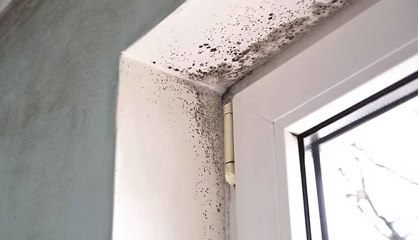
Thermal drone surveys are widely used by housing providers and commercial landlords to detect issues not visible to the naked eye. This is particularly valuable for:
Identifying heat loss and insulation gaps
Detecting moisture intrusion and hidden leaks
Supporting damp & mould investigations
Assessing energy efficiency performance
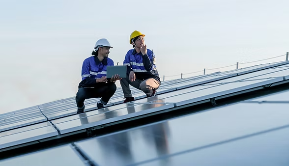
3D drone mapping provides a comprehensive view of your property, using advanced photogrammetry to produce accurate 3D models and maps of buildings and sites. These are ideal for:
Refurbishment and redevelopment planning
Asset management and lifecycle modelling
Site analysis and feasibility studies
Visualising complex structures or roof layouts
PM+ is a RICS-regulated building consultancy, combining drone technology with wider building surveying and property expertise.
Rather than simply capturing aerial imagery, our focus is on helping clients understand building condition and use the information gathered to make informed property decisions.
Whether you’re investigating a specific defect, planning future maintenance or need greater visibility across a property portfolio, our team can provide the surveying expertise needed to support the next step.
A drone survey uses unmanned aerial vehicles to capture high-resolution visual and thermal data of buildings or sites. It allows surveyors to inspect roofs, façades, and other hard-to-reach areas safely and efficiently, without the need for scaffolding or working at height.
Yes. Drone surveys are particularly effective for residential blocks, housing estates, and social housing stock where access can be difficult or disruptive. They allow landlords and housing providers to assess roof condition, defects, and thermal performance quickly while minimising disruption to occupants.
The cost depends on factors such as the size and type of property, the areas being inspected, site location and the scope of reporting required. Contact PM+ for a quote based on your property or portfolio.
In most cases, planning permission is not required. However, drone operations must comply with UK aviation regulations and site-specific restrictions. PM+ manages all operational considerations, ensuring surveys are carried out safely, legally, and with minimal disruption.
You will receive a clear, actionable report tailored to your needs. This may include high-resolution images, annotated defect photographs, thermal analysis, 3D models, and professional commentary outlining findings and recommended next steps.
PM+ provides drone building and property surveys across London and the South East, including Greater London, Hertfordshire, Essex, Berkshire, Surrey, Sussex and Kent.
If you need a roof inspection, thermal imaging survey, or 3D property mapping, our drone survey services provide a fast, safe, and cost-effective solution.
Contact us today to discuss your drone survey requirements and arrange a quote.

info@wearepmplus.com
+44 20 4614 4700
Edinburgh
3 Hill Street, New Town, Edinburgh, EH2 3JP
Newcastle
Suite 6, The Exchange 1856, Howard Street, North Shields, NE30 1SE
London
128 City Road, London, EC1V 2NX